Furness Parkway
Mission
Furness Parkway is a 16-block linear park in the Hayden Heights neighborhood on the east side of Saint Paul following a former street-car line right-of-way just west of McKnight Road. SPBC’s goal is to help facilitate understanding between proponents of the pathway extension and concerned residents.
Furness Parkway Post
posted 09.20.2010The park was initially developed in the early 1980s with pathways on the middle 8 blocks from Ivy Avenue to Hoyt Avenue. Other improvements included site cleanup and grading, installing several benches, and planting trees. The current project is to complete pathway development and improvements throughout the length of the park, particularly at the north and south ends. The project has been approved for financing by the City´s Capital Improvement Budget, with partial funding coming in budget years 2006, 2007, and 2009. The project has been approved by District Council 2 and the Saint Paul City Council.
The improvements include:
- Extending
path paving from Maryland Avenue to Ivy Avenue, and from Hoyt
Avenue to Larpenteur Avenue.
- Install pathway lighting.
- Additional grading and seeding to improve the appearance
and maintainability.
- Tree pruning to improve path safety
and tree health.
- Signage as required.
- Benches and
trash receptacles.
- Property line fencing as appropriate at
adjacent private property.
- Tree planting as needed.
-
Install crosswalks over the parkway at Arlington Avenue and
Sherwood Avenue.
This project has been approved for financing by the City´s Capital Improvement Budget, with partial funding coming in budget years 2006, 2007, and 2009. There is a city project page which will look pretty familiar to anyone who just read the stuff above, but which also has some additional information including improvement cross-sections and a couple of hard-to-read maps.
What
Extensions of the existing pathway at the north and south end. At the moment, with the project approved by the local District Council and the City Council and with funding obtained, it wouldn´t seem that there´s much for us to do. However, the section of trail through the roughly triangular piece of land for the north extension has caused some opposition by neighbors. Broadly speaking, the main concern is that the bicycle path will bring criminal elements close to some local homes, particularly from some crime-prone residences just north of Larpenteur on Beebe. With the path in place, access through the land at the north end will be easier but will also be developed, lit, and more-travelled. In general, bicycle paths do not increase criminal activity, but these neighbors do have a specific identified concern. On the other hand, many residents support the path as attractive public space and useful room for people to exercise and would like to see it completed.
Where
The primary concerns are about the extension at the north end of the trail. Here, the planned path extension goes through a city-owned lot which is currently vacant and not used for anything. The site can be seen on the Google map below.
The current trail ends at Hoyt Avenue, visible on this map. You can see the trail on here dividing east and west at Hoyt. The extension will take the trail from Hoyt up to Larpenteur Avenue East, which forms the northern border of Saint Paul here. The A pin is about the point where the trail goes into the city-owned triangular bit of land that seems to be causing some concern. Click this map to "Sat" view and you can see this wooded piece of land somewhat better.
We've prepared a downloadable map that shows the Furness Parkway Trail Extension´s north end with property lines and street names superimposed on a 2009 aerial survey of the area.
When
Although District Council 2 has approved the plan and the City Council has passed it, there is some neighborhood opposition and there have been a couple of further hearings with the District Council to hear concerns. Several SPBC members attended the meeting held October 20. This meeting was also attended by about 15 neighborhood residents, a Parks and Recreation representative and of course the council itself. There were statements given both against and in favor of the extensions. In the end, all but one of the district council members voted to proceed. It's not clear that the SPBC support had much effect here; the project has been driven by District Council 2 from the beginning.
Who
This project is in Saint Paul´s Ward 6 represented by Councilmember Dan Bostrom. Go ahead and e-mail him your thoughts. The area is served by Greater East Side Community Council (Council 2 of the 17 in the city).
How
The Saint Paul Bicycle Coalition supports this trail extension project. It helps complete the existing Furness Parkway trail, improves lighting and facilities along the trail, and connects to Larpenteur Avenue on the northern border of Saint Paul. How to support it? Right now, it doesn't appear that there is anything to do. The SPBC sent letters of support prior to the October 20, 2010 meeting and had people there to comment on the project. The District Council voted to recommend proceeding with the existing plan at that meeting. We will monitor the situation to see if there is further action needed.
Further Developments
The Furness Parkway Extension was featured in a Saint Paul Pioneer Press article on the Saturday November 6, 2010. We're quoted, which is cool, and there's a link to this page after the article. The resident quoted in the article is on the District Council and was the only dissenting vote at the October 20 meeting.
So What´s This Look Like, Anyway?
Below are some photos of the Furness Parkway Trail and points of interest. We start at the south end and work north in these photos. If you want to see them in more detail, click on the photo and you can see a larger version.
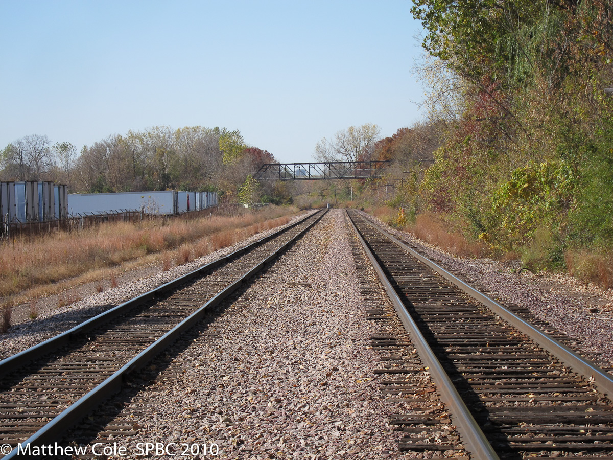
The Furness Parkway Trail Extension would fill in some gaps in a useful north/south route which parallels White Bear Avenue. This bridge (Bridge 62556 built in 1988 (although at least one source refers to it as a recycled pedestrian bridge that did years of service on Hamline Avenue), carries the trail over the Union Pacific railroad tracks, connecting Hazel Street south of the tracks to the trail which goes up to Hazel and Maryland on the north side of the tracks. October 2010
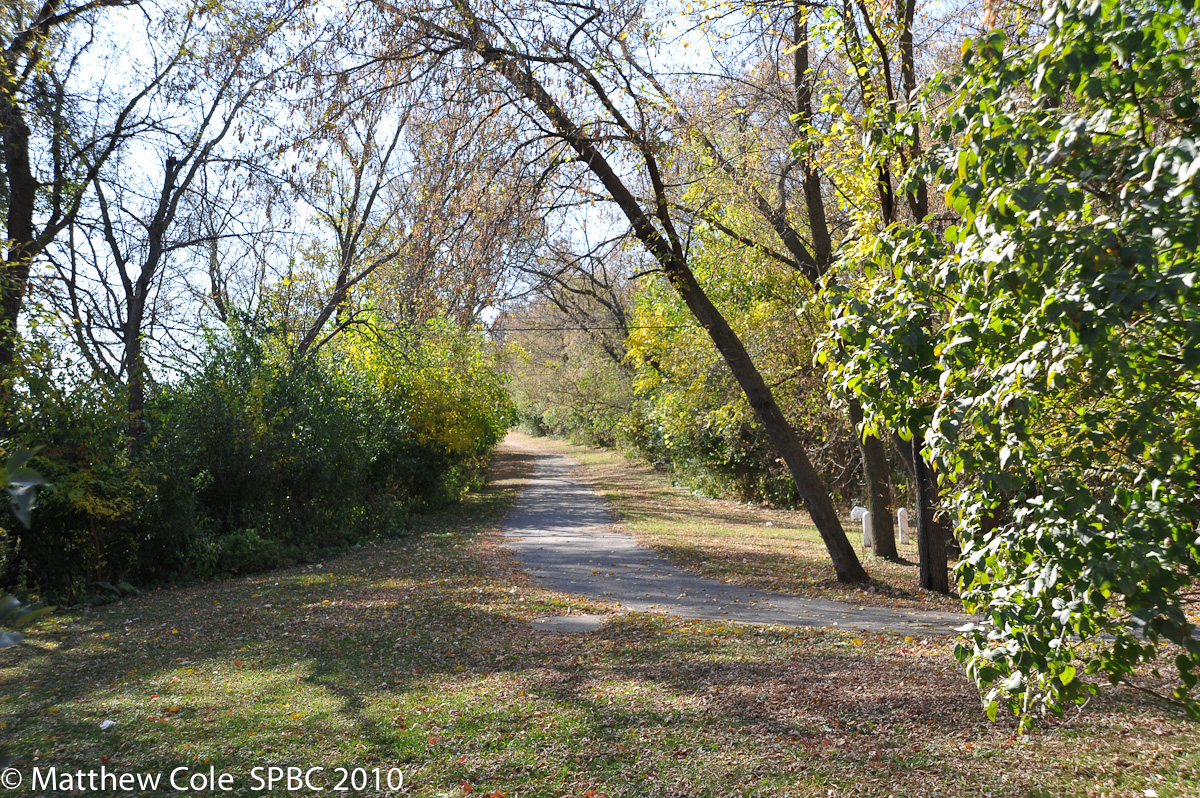
This is the mixed-use trail heading south from Maryland and Hazel towards the railroad bridge. The trail extensions would be a full 10 feet wide; this is more like 8 feet. October 2010
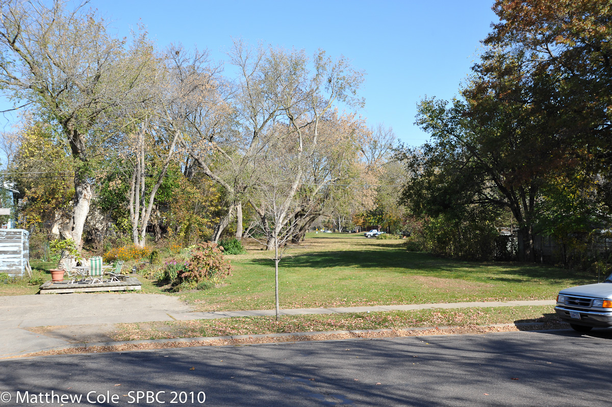
From Maryland and Hazel there is a four block gap before the existing Furness Parkway Trail starts. The southern part of the extension would close this gap, right up this old streetcar line right-of-way. This photo looks NNE from Hazel and Maryland. October 2010
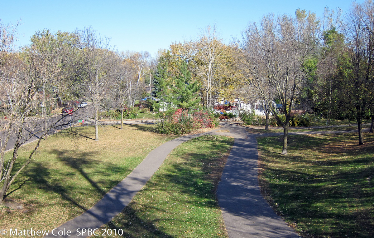
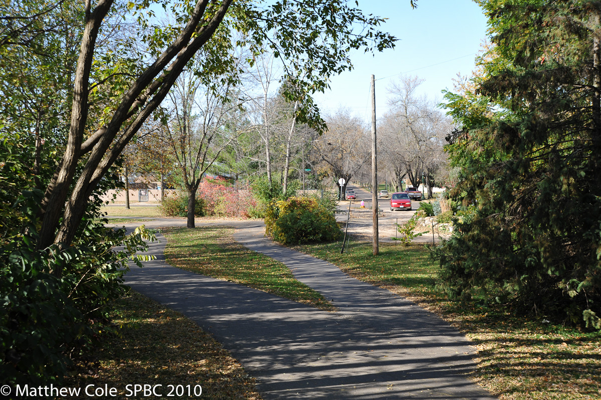
The existing Furness Parkway Trail runs from Ivy Avenue to Hoyt Avenue along the old streetcar right-of-way. It is two paths that meander along a bit. This shot is from Clear Avenue looking north. October 2010
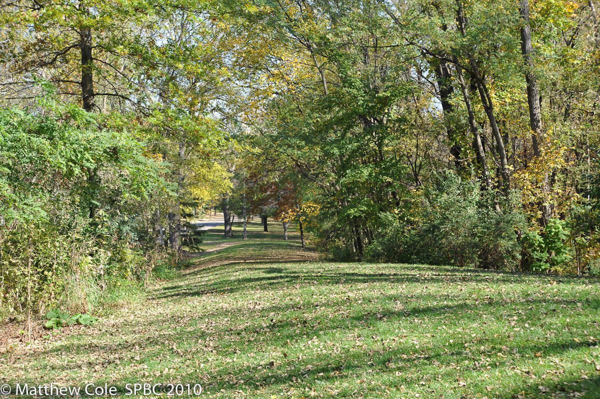
Towards the north end of the existing trail. Furness Parkway exists on both side of this wide right of way. The original farmhouse, though much altered, is at 1488 Furness. The street was named after Marion Furness, the daughter of Governor Alexander Ramsey, who inherited this farm when he died. October 2010
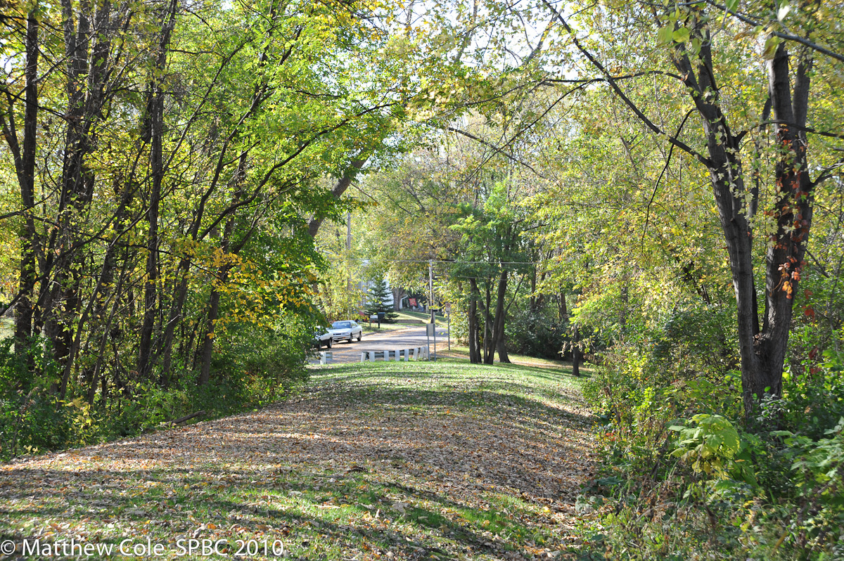
When the existing path gets to Hoyt Avenue, it splits and goes to both Hoyts. Hoyt is interrupted by the parkland although a stub of it is used as a driveway by a homeowner. October 2010
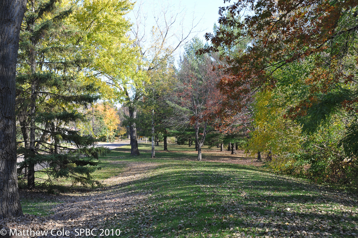
At the north end of the existing trail, looking west down Hoyt Avenue East. October 2010
At the north end of the existing trail, looking north up the right-of-way for the Furness Parkway extension. Some of this land is designated as wetlands from about here to Larpenteur. Neighbors say the raised berm here is to prevent water flooding into the road. October 2010
The same bit of right-of-way, looking south from Iowa and Furness. The road just left of center is where Furness Parkway turns east into Hoyt. October 2010
From the same spot as the last photo, looking north along the parkland planned for the northern extension. Furness Parkway the street is on the left. There are no immediately adjacent homeowners in this stretch. October 2010
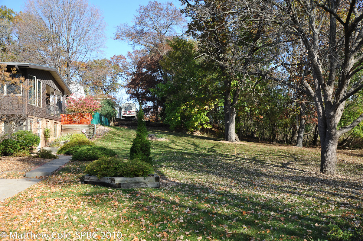
The last bit of the northern extension goes from California and Furness up to Larpenteur. It goes past these homes, and if you look carefully you can see one of the survey stakes in the ground. The property line appears to run just about along the sidewalk on the left side of the photo--the rest is city land. October 2010
This would be the last bit of the trail up to Larpenteur Avenue East, which is the northern border of Saint Paul and thus the terminus for this particular city project. You can see a survey stake in this photo as well. October 2010
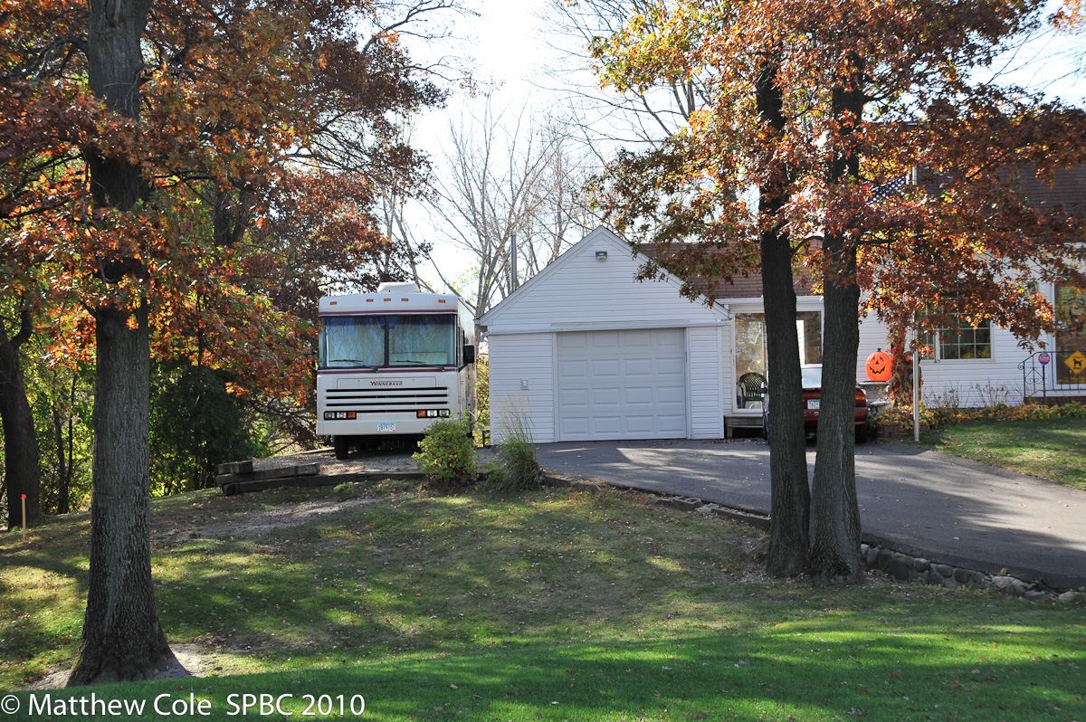
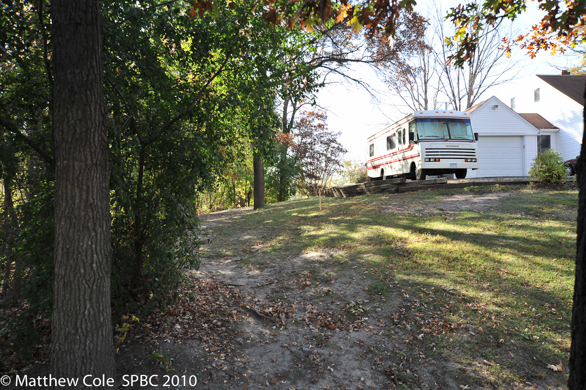
The trail appears to come close to this homeowner's property, as you can see a survey stake at the far left of the photo. However, it may be that the driveway with the RV parked on it is built on city land. The February 18, 2009 meeting notes mention that several encroachments were discovered during the project surveys and the Ramsey County GIS map, while not an official survey, make it appear that this might be built over the property line. October 2010
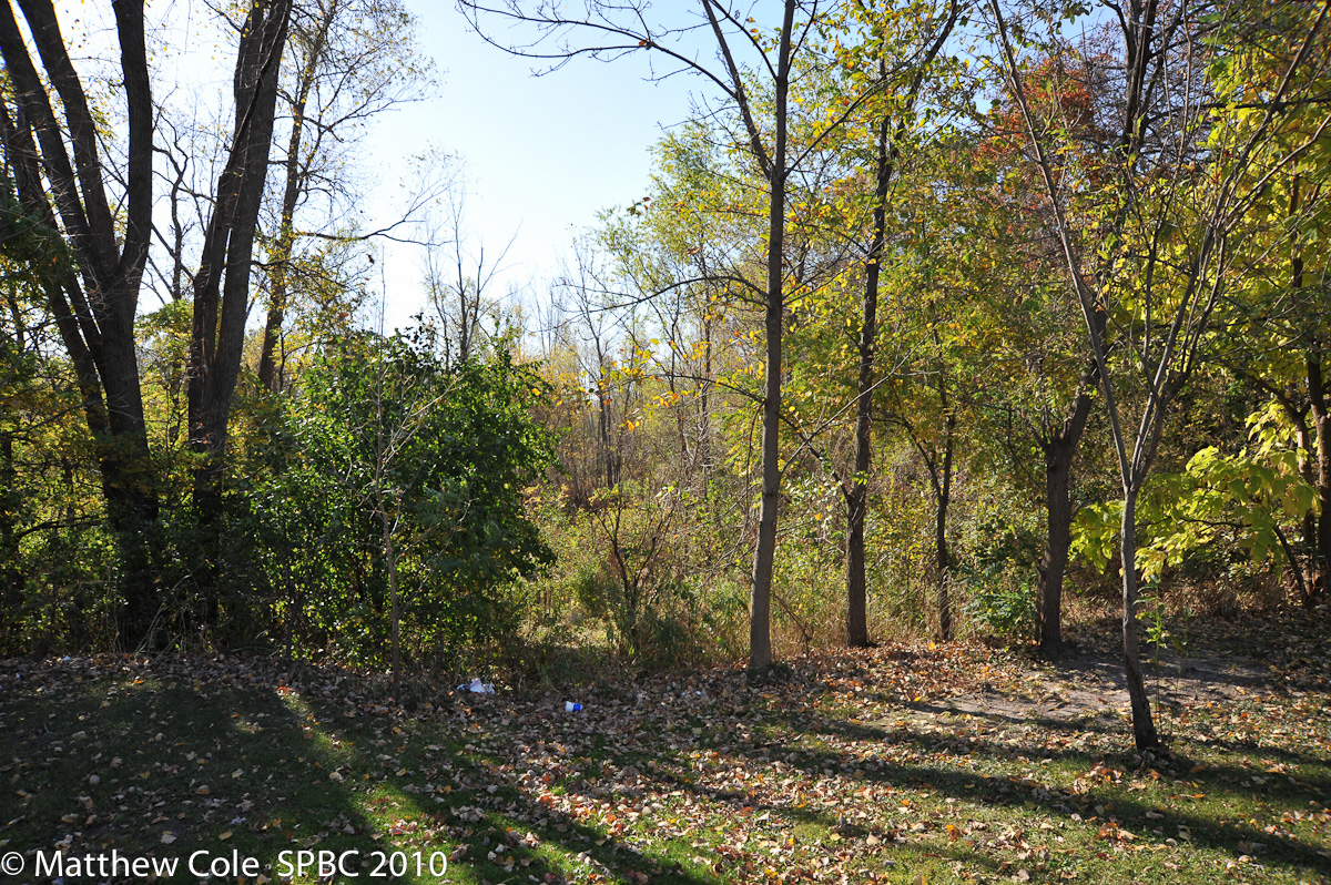
The city owns quite a bit of land at this end but the middle of it is mostly a bog. At the October 20, 2010 meeting, neighbors noted that this used to be an actual pond but that in the 1960s the Water Department did some work so that it runs to a sewer by Hoyt (we have not confirmed this with the City). The Parks and Rec representative said that they were looking at the possibility of a raised boardwalk bridge over this wetland, further away from the homes. He felt the cost might be similar to the proposed bit of trail on the hillside if permission could be obtained to build the boardwalk/bridge. October 2010